New York
Painting the City Blue?
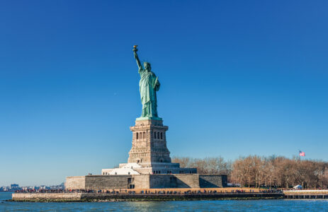
If New York Harbor rises all around her, as shown in this photo illustration, will the Statue of Liberty keep her toes dry? As the rising sea charges in near the New York Stock Exchange, will the Wall Street Bull keep its head above water? Will these statues continue to stand for the hopes and dreams of many New Yorkers, or will they become symbols of the city’s sinking fortunes?

Spotlight On …
New York
Where in The World? East coast of the United States
Home to: 8,550,405 people
Size: 302.64 square miles (784 sq km)
Sea-Fearing Heights: some parts are only 5 feet (1.5 m) above sea level; others are at sea level
By 2100, Sea Level Rise May Threaten: 400,000 people
Slr Game Plan? P for protect and A for adapt
Priceless Treasure: Statue of Liberty, a gift from France that has become a worldwide symbol of freedom
As sea levels rise, the Big Apple could take a big bath. New York City has the longest coastline of any city in the United States.

Not much stands between Manhattan, the most densely populated area of New York City, and rising water.
Here and Now
Seeing as Lady Liberty’s Toes are perched 154 feet (47 m) above the harbor, the rising water’s unlikely to reach them–even by 2100. Not so for the Wall Street Bull (see page 17). Standing near the shore of lower Manhattan, the bull is set to meet the rising sea head on. If only it could beat the water back. In New York City (NYC), seawater is climbing twice as high as the global average. What’s up with the water there? Scientists think there are two things going on. One, changes in ocean currents, which carry tons of water around the sea, are piling up water on the coast of NYC. Two, the city is sinking. During the last ice age, glaciers pressed down heavily on nearby land. In response, the surrounding land, including present-day NYC, bulged. Once the glaciers melted, the bulge began to sink. And it hasn’t hit bottom yet.
Fast Forward to The Future
Three Feet, Six Feet … however much global sea level jumps by 2100 and beyond, the water’s bound to jump higher in NYC (see page 16). So the city is taking steps to prepare. Back in 2008, then mayor Michael Bloomberg put a group of scientists together with city planners. The scientists’ job was to predict local SLR, and the city planners set about looking for ways to protect local buildings and adapt to the challenges–for example, building seawalls, adjusting building code or rules, raising key buildings, and restoring wetlands to buffer rising water. Nevertheless, if our carbon emissions continue at their current rate, huge coastal areas of NYC will end up underwater, including all but the tip of the tail of the Wall Street Bull (see photo illustration, below).

When Hurricane Sandy Hit NYC in 2012 …
All sea broke loose. A 13-foot-high (4 m) gush of seawater stormed over the seawalls of Manhattan, spilling onto highways and city streets. The seawater flooded roadways, tunnels, subway stations, and Wall Street’s power system. In fact, the flooding knocked out power for part of Manhattan. New Yorkers got a glimpse of how sea level rise could affect the city and stepped up their plans to tackle SLR. As then mayor Michael Bloomberg declared, “We cannot, and will not, abandon our waterfront.”

The super-strong winds of Hurricane Sandy raised havoc and the sea, wrecking whole neighborhoods in Manhattan.
Reprinted with Permission from Rising Seas: Flooding, Climate Change and Our New World by Keltie Thomas and Published by Firefly Books, 2018.


